Portfolio
The projects below provide a selection of the work I have completed both during my studies and professionally. They cover the areas of GIS work completed, Publications worked on, Environmental Management Reports relating to Australian Standards and Video editing work completed.
GIS Work
01

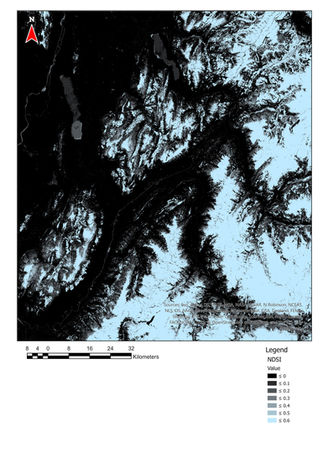
Utilising Google Earth Engine and Sentinel-2 Data for Snow
cover mapping in the French Alps
Software: Google Earth Engine, ENVI, ArcGIS Pro
Utilising Google Earth Engine and implementing a combination of established remote sensing practices an algorithm for snow cover classification was established and implemented for an array of images from the Sentinal-2 program.
02
Building Bridges to a Better Brisbane
Software: ArcGIS Pro, ArcGIS Online, ArcGIS Story Map
This project utilised network and accessibility analysis to assess the impact of three new pedestrian bridges on three key livability aspects in Brisbane, Australia. The project utilised Model Builder Functionality to automate the process. The final output of this project is displayed in the below story map with a brief discussion of the results.


03
Land Suitability Assessment
Software: ArcGIS Pro
This project implemented a variety of techniques to assess suitability for urban development. The assessment included effects such as impacts on native flora and fauna, suitability for construction and likelihood of natural disaster affecting areas of the site. The final results display areas recommended for integration into the already existing and bordering national park and areas for light Rural Living Development.
Data Analysis
01

Online database of geospatial practices and dashboard for reporting on the implementation of the Asia-Pacific Plan of Action on Space Applications for Sustainable Development (2018-2030)
Software: Microsoft PowerBI
Project Developer including research and development of platform alternatives, data structure, database design, dashboard design, visual design and graphics and data analysis
Publications
Environmental Management

01
Conservation Action Plan - Alpine National Park, Victoria, Australia
Developed a conservation action plan for three threatened species or communities within the Alpine National Park, Victoria, Australia. Australian Guidelines were used and research was conducted to determine trends, threats, condition and management options for each species and community.
02
Environmental Impact Assessment - Whitsunday Islands Resort Development - Report
A report was written with the aim to assess an existing Environmental Impact Assessment (EIA) under topics of ethicality, ability to meet Australian EIA Standards and appropriateness of findings.


03
First Pass - Climate Change Risk Assessment - North Queensland Resort Assessment
Developed a first-pass climate risk assessment under the NCCARF methodology. This desktop study of the site included all climate risks, assessed the sustainability of business operations at the site and provided recommendations on purchase, further investment and potential climate hazards.
Video Editing
01
Geospatial Practices for Sustainable Development in Asia and the Pacific 2020: A Compendium - Promotional Video
Software: Adobe Premiere Pro
Storyboard drafting, writing, video acquisition, editing and development of the promotional video for the "Geospatial Practices for Sustainable Development in Asia and the Pacific 2020: A Compendium" Publication.


